|
|
Madagascar satellite map with parks, cities, and roads labeledClick on the map to zoom.SHOW: Cities | Roads | Protected Areas | All CLICK: Zoom | Information 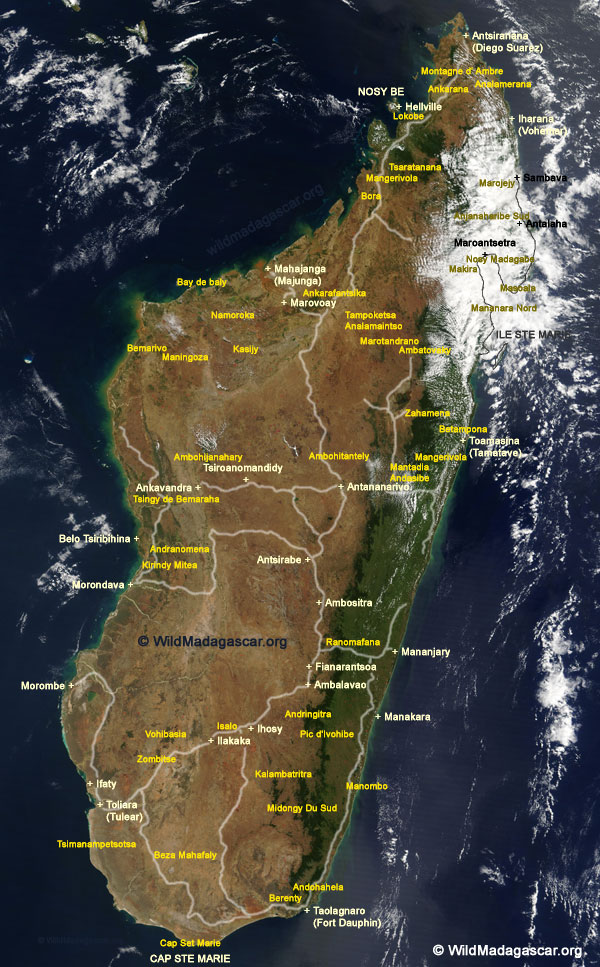
Click map The above image has been adapted from a NASA satellite photo. To learn more visit The Earth Observatory |
|
home | photos index | search | about | contact Unless otherwise noted, all content and images are the property of Rhett Butler, content copyright 2004-2006. All rights reserved. |