|
|
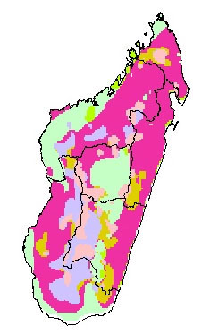
Map showing environmental constraints to agriculture in MadagascarThis map has been adapted from the FAO Country Profiles and Mapping Information System (The United Nations Food and Agricultural Organization) materials. All data is copyright � FAO 2004.
Madagascar MAPS Index. The above image has been adapted from a NASA satellite photo. To learn more visit The Earth Observatory |
|
home | photos index | search | about | contact Unless otherwise noted, all content and images are the property of Rhett Butler, content copyright 2004-2006. All rights reserved. |